
Motorcycle tour featuring 5 classic Swiss Alpine passes.
205-kilometre motorcycle tours through the cantons of Uri, Valais and Bern.
This motorcycle tour is a varied 1-day tour starting and ending in Brig.
Brig is a small town in the heart of Valais. It is characterised by its rich medieval history, written by the ‘King of the Alps’, Kaspar Stockalper. A visit to his ‘castle’ in the centre is a must.
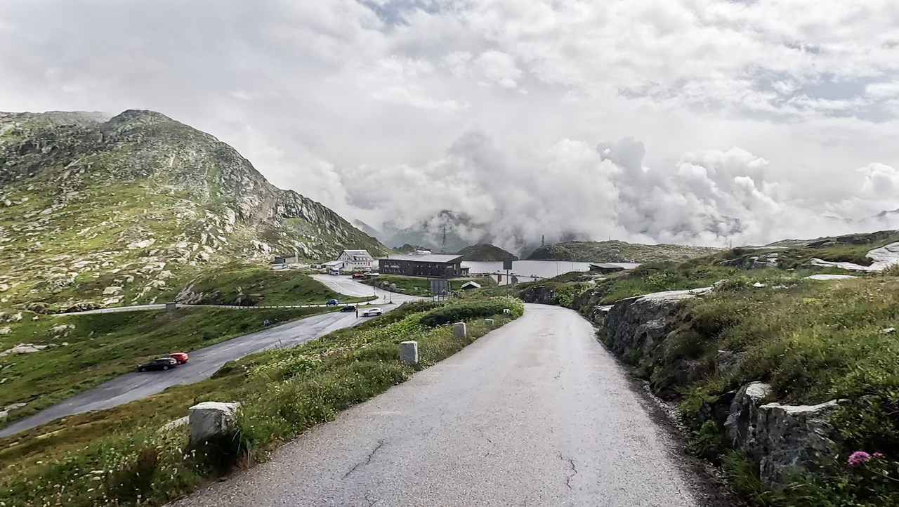
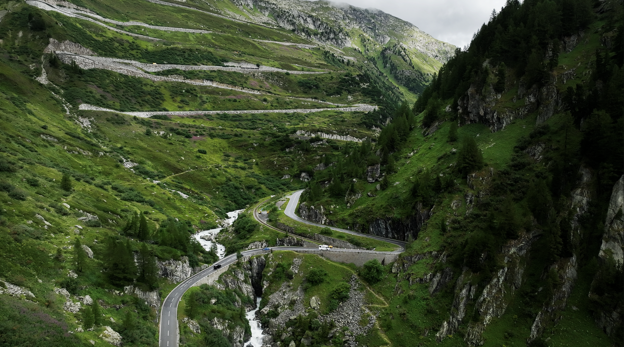
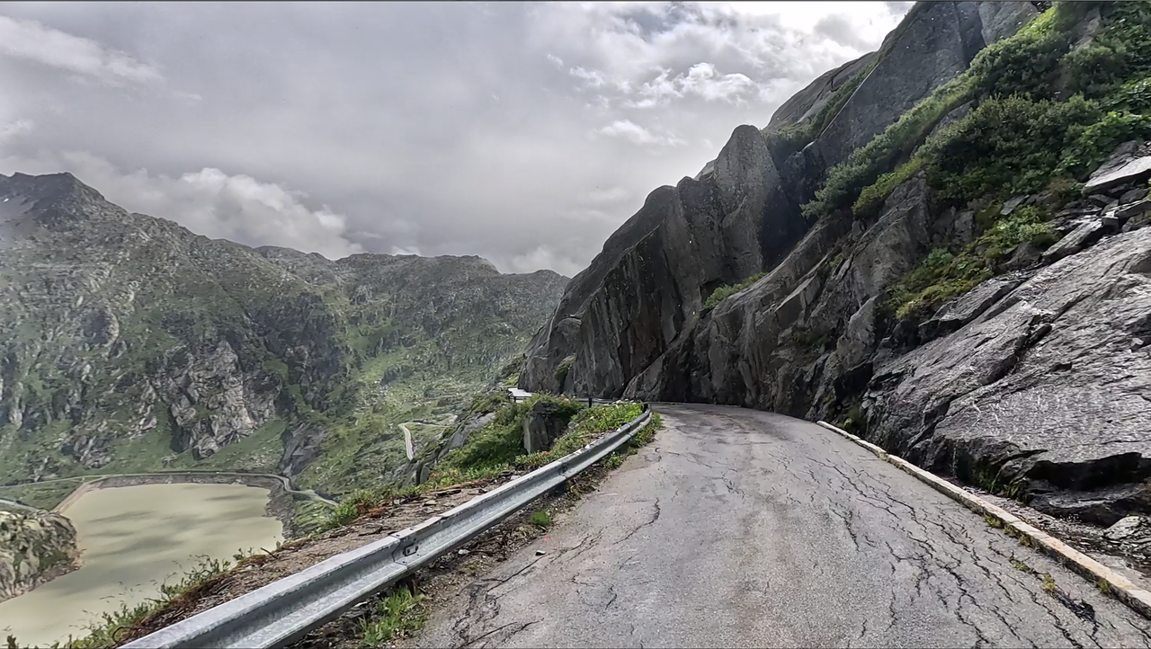
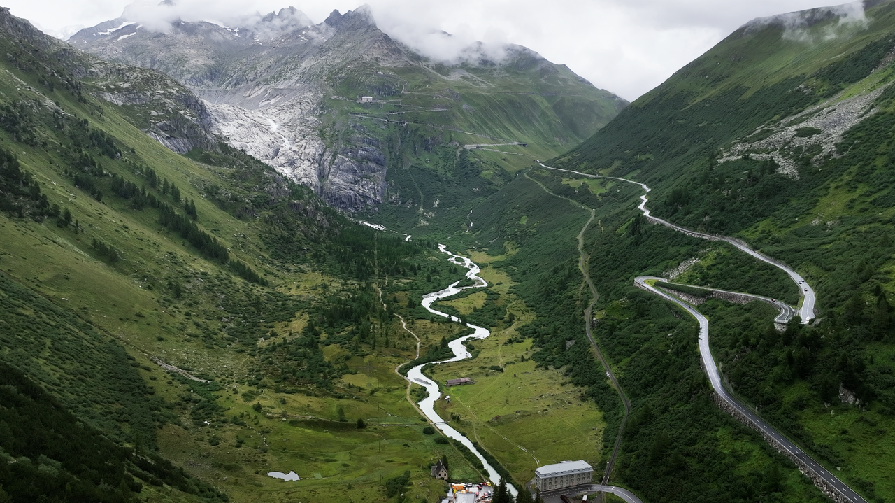
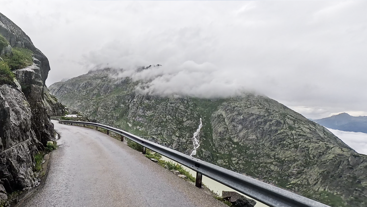
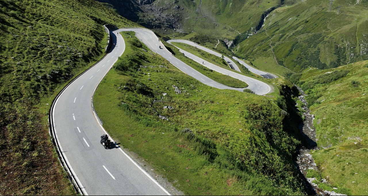
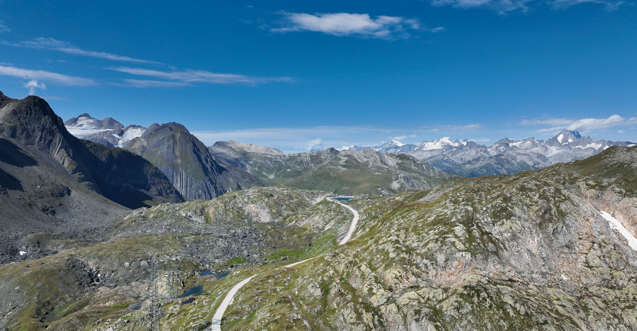
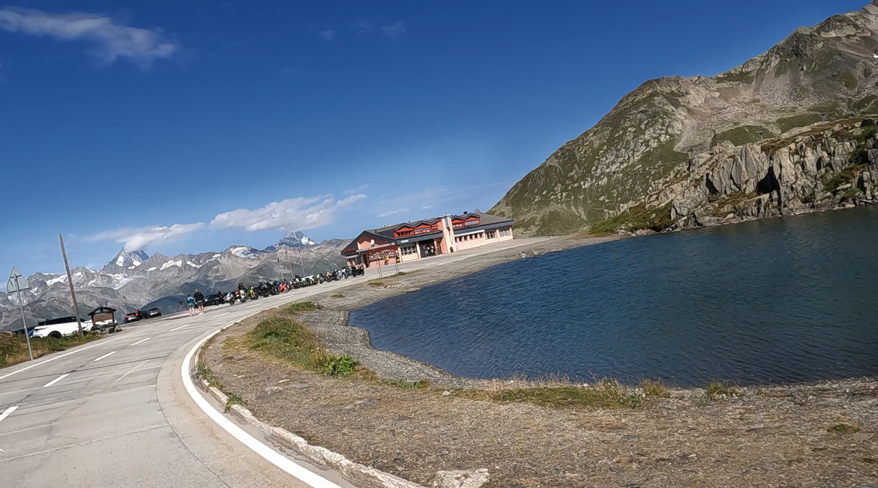
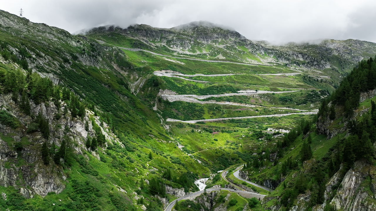
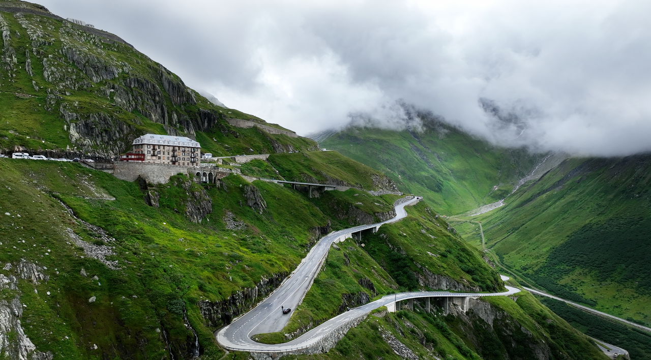
At 205 kilometres, the motorbike tour is not particularly long, but it invites you to stop and marvel all the more. The five, or rather four, Alpine passes and one high-altitude road offer many breathtaking views. The motorbike tour is described in the following order: Brig, Grimsel Pass, Oberaar Panoramic Road, Furka Pass, Andermatt, St Gotthard Pass (if possible: Tremola), Nufenen Pass and back to Brig.
Stage 1: Brig – Grimsel Pass, 40 kilometres of beautiful Valais.
The first 40 kilometres or so of this motorbike tour lead through the valley of the Rhone, which is still very inconspicuous here. There is already a good 650-metre difference in altitude from Brig to the starting point of the south-west ramp, to Ulrichen. This is where the round trip will rejoin the 4 Alpine passes and the high road.
On the way to Ulrichen lies the small village of Geschinen. Well worth seeing! It captivates visitors with a row of very old, well-preserved houses and stables.
The first winding passages begin about 5 kilometres after Ulrichen from Obergoms. From here on, the valley becomes narrower and the mountains higher. The landscape is rocky and well forested in places. The road is wide and the asphalt, like the entire route of the day tour, is always in good condition.
This is also where the famous ‘Furka Mountain Steam Railway’ crosses the route for the first time. It starts in Oberwald, just before Obergoms, and we will encounter it again and again on our way to Hospental, and in places we will be thrilled by its route.
Shortly before the village of Gletsch, there are a few more bends and hairpin bends to negotiate. From here, you can now see the famous serpentine road that leads up to the first stage of the motorcycle tour, the Grimsel Pass. Here, you now drive close to the tracks of the narrow-gauge railway.
In Gletsch, we leave the route and turn west, up to the 2,165-metre-high Grimsel Pass. This is followed by six 180-degree hairpin bends, which bridge the steep slope up to the pass. In the hairpin bends heading north, looking towards the Furka Pass, there are good opportunities to stop and enjoy the view up the Rhone Valley – for example, to the Rhone Glacier.
At the top of the pass, there are hotels and restaurants lined up along a small high mountain lake, the Totensee. If you have the time and inclination, it is also worth visiting a small marmot park.
You should definitely plan a short stop, as the view on both sides of the Grimsel Pass is magnificent.
12 kilometres of breathtaking views: that's the Oberaar Panoramic Road.
At the western end of Lake Totensee, just before the road descends again towards Innertkirchen, it branches off to the next destination, the Oberaar Panoramic Road.
The road is very narrow and poorly paved on the steep valley slopes. Therefore, it is only open to single-lane traffic. A traffic light regulates the traffic, making the mountain road very relaxing to drive on. The Oberaar Panoramic Road is a dead end. It ends after about 6 kilometres at the Oberaarbahn mountain station. On the way there, there are a few small parking bays that invite you to stop. A view of the ice-cold, grey-green Grimselsee lake is a must.
At the mountain station, it's time to turn back. The next destination is the Furka Pass. So you drive down the many 180-degree bends of the Grimsel Pass, back into the high valley to Gletsch.
Panoramic views, bends, glaciers, ice caves and a photogenic hotel – that's the Furka Pass.
In Gletsch, turn left back onto the Furka Pass road, which winds its way through the former small but important transport hub in a 180-degree arc. The Glacier Express in particular made the place so famous from the 1930s onwards. It ceased operation in the 1980s. Today, as already mentioned, a steam train runs here again.
But the use of hydropower was also a central theme in Gletsch. If you have the time and inclination to stop, ask about the numerous exhibitions at the information point in the village centre.
After a few hairpin bends, the road winds its way along the edge of the high valley towards the glacier area. The Rhone Glacier above the Belvédère is clearly visible from a distance.
But there are still a few hairpin bends to negotiate before you reach the Belvédère.
There is a large car park off the bend near the hotel. Stop, take some photos and/or walk up to the ice grotto. Allow at least an hour for your visit here.
Even though people often think that the Belvédère is the top of the pass, this is not the case. From here, there are still a few bends and kilometres to go before you reach the rather inconspicuous pass summit. The few houses flanking the pass summit are now abandoned.
From here, the road descends to Realp via 11 bends and hairpin bends. Along the route, the Furka Steam Railway line can be seen repeatedly below in the valley. It is unique in the way it winds its way through the rocky high mountain terrain. After about 12 kilometres, in the small village of Realp, the ramp is almost mastered. This is also where the steam railway's terminus station is located. Another 6 kilometres or so and Hospental is reached. Here we meet the St Gotthard ramp – the Furka Pass is behind us.
Cruising or winding – the alternative routes of the St Gotthard Pass.
Today, Hospental is just a small roadside village that lost all its importance with the construction of the railway line at the end of the 19th century. Until then, it had thrived as a transport hub for the St Gotthard Pass, Furka Pass and Oberalp Pass, with coach services and hotels.
In Hospental, we take the road up to the St Gotthard Pass. However, at an altitude of almost 1,500 metres, Hospental is not at the foot of the northern ramp. The Gotthard road is already many kilometres long here. Therefore, the ascent is completed after just a few kilometres and is merely scenic. That's okay, because the appeal of this stage lies in the descent.
The summit of the Sankt Gotthard Pass is a long plateau with several small high alpine lakes at an altitude of around 2100 metres. The largest, Lago de Piazzi, is home to the Ospizio and other bars and restaurants.
At 110 kilometres, this is the halfway point of the motorcycle tour – an ideal time for a lunch break and refreshments. Now it's time to descend the Tremola to Airolo, and then on to the highest Alpine pass in Switzerland, the Nufenen Pass.
The Tremola – a winding, cobbled alternative to the classic tourist route.
First of all: the cobblestones are laid extremely evenly, creating a nice, straight surface. In addition, the descent is only moderately steep. Nevertheless, there is of course the option of following the asphalted route. Both routes meet shortly before Airolo.
The Tremola starts right at the Ospizio. (By the way: in bad conditions, the Tremola is closed by a barrier). A multitude of bends, each one more beautiful to drive than the last, lead down into the valley. Here you can expect little traffic and lots of driving pleasure. Above the descent, you can see the impressively long gallery, but the asphalt road is still relatively boring.
After 24 beautiful and evenly curved bends and hairpin turns, the Tremola meets the asphalt road. From now on, it's back to relaxed cruising. Another 5 bends and the tour reaches Airolo, the starting point for the last stage of the one-day tour.
By the way, we have now arrived in the fourth Swiss canton – albeit only for a few kilometres. The section from the St Gotthard Pass to the Nufenen Pass is already in Ticino, or Tessin in German.
The Nufenen Pass – the highest Alpine pass in central Switzerland with an incomparable panorama.
The road up to Nufenen is well paved, as it is throughout Switzerland, and wide. The road up the east ramp is ideal for relaxed cruising. It is the perfect way to end an eventful day. And yet, a special highlight awaits you when you reach the top of the pass. There is a particularly large car park here, as the average length of stay for Alpine tourers is certainly above average. This is because this plateau offers a stunning panoramic view of the Bernese Alps.
The descent towards the west is more winding and varied. After 9 bends and hairpin turns and 14 kilometres, we rejoin the country road at Ulrichen, which we took at the start of the tour towards the Grimsel Pass.
From here, we head back towards the small town of Brig.
Tip for Brig: Be sure to visit the old town and, above all, Kaspar Hochalper's Brig Castle. When the businessman, who came from a simple farming family, reached the peak of his career, he had a castle built. After all, he was called the ‘King of the Alps’ and was even allowed to save the lives of queens and princes. The castle bears witness to his fame.
Tip for overnight stays: The Brig Castle Hotel takes its name from its proximity to the castle. It is very centrally located, offers parking for motorcycles and is a good mid-range hotel, making it affordable. The owner is a passionate motorcyclist.
Matching: Alpine passes