The Hengst Pass, 965 metres: the gateway to the north-eastern Alps.

5 days ago
Passo Rest, 1,052 metres: 30 hairpin bends and curves, woodland, a tunnel … a truly special Alpine pass in Friuli.
2 weeks ago
Col d'Illoire – a 180-degree bend with a view down into the 700-metre-deep Verdon Gorge.
3 weeks ago


Region: Vorarlberg
Hochtannbergpass | 1697 METER | Schröcken Warth
The Hochtannbergpass is a mountain pass in Vorarlberg that separates the Allgäu Alps from the Lechquellen Mountains. It connects the Lech Valley near Warth with the valley of the Bregenzer Ach near Schoppernau. The Bregenzerwaldstraße runs over the Hochtannbergpass, reaching an altitude of 1676 metres. A temporary security barrier is in place during the winter in bad weather or snowy conditions.
More images of the pass:
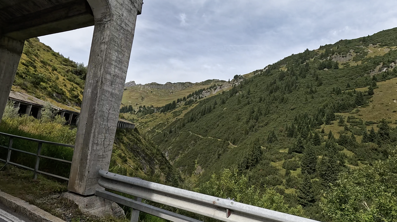
Hochtannberg Pass: the most striking feature of the eastern ramp is the long gallery leading towards the top of the pass.
Hochtannberg Pass: the most striking feature of the eastern ramp is the long gallery leading towards the top of the pass.
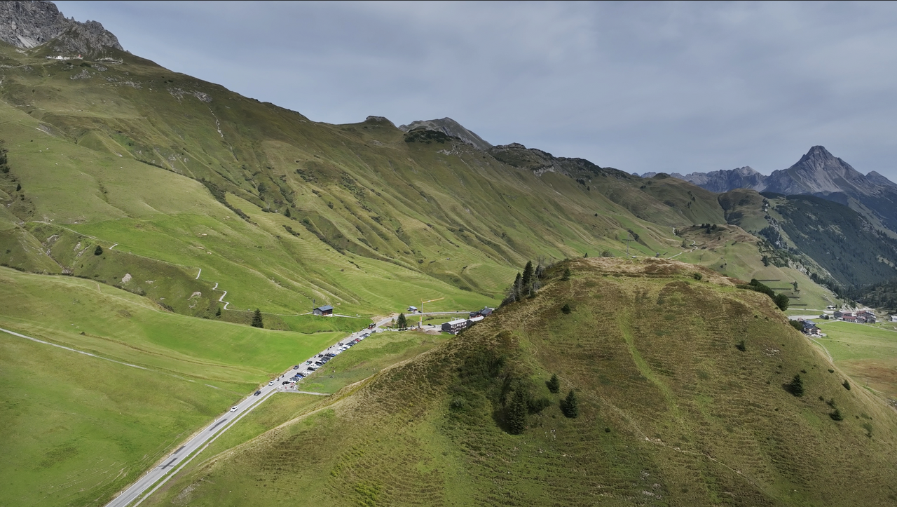
The Hochtannberg Pass with a view towards the east – towards Hochkrumbach.
The Hochtannberg Pass with a view towards the east – towards Hochkrumbach.
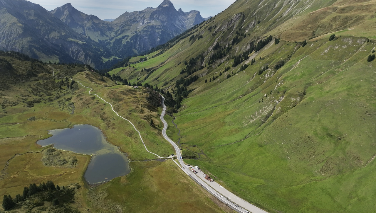
The Hochtannberg Pass with a view towards the west – in the background: Lake Kalbel.
The Hochtannberg Pass with a view towards the west – in the background: Lake Kalbel.
Passtracks close by:
Flexenpass, Arlberg, Faschinajoch, Riedbergpass, Furkajoch
Suggested videos (Passtracks close by)
Über den Arlberg
12 years ago
Arlberg, nach Lech!
12 years ago
Richtung Arlberg: das Lechtal!
12 years ago
| Country | Österreich |
| Region | Vorarlberg |
| Coordinates | 47.26970000, 10.13110000 |
| Elevation | 1697 m |
| Max. slope | |
| Toll road | no |
| Road surface | Asphalt |
| Cul-de-sac | no |
| Length | 10 Km |
| Travel time | Normal |
| Route | Schröcken Warth |
 overcast clouds, 9.5°C
Back to hotel