

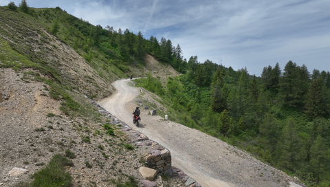
Strada delle Tre Valli – a 17-kilometre route of gravel and tarmac for off-road beginners.
6 days ago
Passo delle Fittanze della Sega | 1,393 metres: 30 hairpin bends, a 20 per cent gradient and 100 per cent panoramic views.
1 week ago
Colle di San Fermo | 1,074 metres: The western approach alone is a motorcyclist’s paradise, with 40 bends.
2 weeks ago



Region: Rhône-Alpes
Col de Robines | 988 METER | Saint-André-les-Alpes Moriez
An unspectacular mountain pass, a simple connecting road from Moriez in the west to Saint-André-les-Alpes in the east. It continues south to Lac de Castillion. Lac de Castillion is the centre of an extensive recreational area, fed by the river Le Verdon.
Passtracks close by:
Col de Toutes Aures, Col des Lèques, Col de la Colle-Saint-Michel, Col de Luens, Col de l'Orme
| Country | Frankreich |
| Region | Rhône-Alpes |
| Coordinates | 43.96201070, 6.49302960 |
| Elevation | 988 m |
| Max. slope | |
| Toll road | no |
| Road surface | Asphalt |
| Cul-de-sac | no |
| Length | 4 Km |
| Travel time | Fast |
| Route | Saint-André-les-Alpes Moriez |
 overcast clouds, 6.7°C
 Subscribe to Newsletter