


Col de l'Echelle | 1762 METER | La Vachette Bardonecchia
The road over the Col de l'Echelle leads from La Vachette in the Val de Prés to Bardonecchia in the Susatal. Actually, the transition consists of two pass heights, a vertex located just before the Italian-French border, which is referred to in some maps as Le Mauvais Pass and the Col de l'Echelle, which is further south. Between the two summits lies a long high valley.
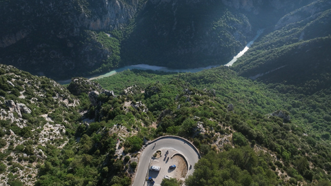
The French side is relatively unspectacular to drive. After just a few bends, you reach the pass summit, which is because the starting point La Vachette – between Col de Montgenevre and Briancon – is already at over 1400 metres. The Italian side, on the other hand, is exciting. The road is characterised by a few bends, great views of the Susa Valley and the surrounding high Alpine peaks, and various tunnels.
The Col de l'Echelle and, further on, the Col du Mont Cenis – which can be reached via Susa – can be an alternative to the route over the Col de Télégraphe, the Col du Galibier and the Col de Lautaret, in the direction of or from Briancon and the Maritime Alps, should the Col du Galibier be closed – and of course it is also good for a round trip – from and to Briancon, about 200 kilometres.
Tip: plan a visit to the forts in Exilles (Susa Valley) and Victor Emanuel – both are well worth seeing and have been spectacularly built into the landscape.
Videos
Suggested videos (Passtracks close by)
| Country | Frankreich |
| Region | Hautes-Alpes |
| Coordinates | 45.02640000, 6.65667000 |
| Elevation | 1762 m |
| Max. slope | |
| Toll road | no |
| Road surface | Asphalt |
| Cul-de-sac | no |
| Length | 28 Km |
| Travel time | Normal |
| Route | La Vachette Bardonecchia |
 broken clouds, 15.3°C
Hotels close by