

Strada delle Tre Valli – a 17-kilometre route of gravel and tarmac for off-road beginners.
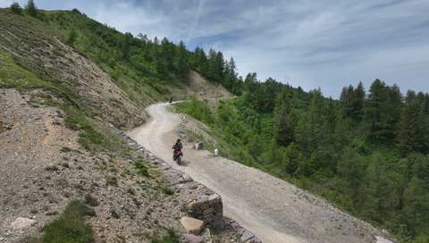
6 days ago
Passo delle Fittanze della Sega | 1,393 metres: 30 hairpin bends, a 20 per cent gradient and 100 per cent panoramic views.
1 week ago
Colle di San Fermo | 1,074 metres: The western approach alone is a motorcyclist’s paradise, with 40 bends.
2 weeks ago





Bielerhöhe (Silvretta) | 2032 METER | Galtür Partenen
The Bielerhöhe, with a pass summit at 2032 metres, connects the Montafon Valley in Vorarlberg with the Paznaun Valley in Tyrol. It is the highest accessible point on the Silvretta-Hochalpenstraße, a toll road over the Bielerhöhe that is closed to normal traffic in winter (November to April) due to its exposed location.
Current status regarding access: The west ramp is closed until 2030, it is expected, due to extensive construction work following rockfalls and flooding.
Passtracks close by:
Zeinisjoch, Wolfgang-Pass, Flüelapass, Arlberg, Flexenpass
Suggested videos (Passtracks close by)
Über den Arlberg
12 years ago
Arlberg, nach Lech!
12 years ago
Richtung Arlberg: das Lechtal!
12 years ago
| Country | Österreich |
| Region | Tirol |
| Coordinates | 46.91780000, 10.09190000 |
| Elevation | 2032 m |
| Max. slope | |
| Toll road | no |
| Road surface | Asphalt |
| Cul-de-sac | no |
| Length | 22 Km |
| Travel time | Normal to slow |
| Route | Galtür Partenen |
 moderate rain, 2.2°C
Back to hotel
 Subscribe to Newsletter