

Passo della Borcola, 1,250 metres: hairpin bends, a narrow road and little traffic.
6 days ago
Strada delle Tre Valli – a 17-kilometre route of gravel and tarmac for off-road beginners.
3 weeks ago
Passo delle Fittanze della Sega | 1,393 metres: 30 hairpin bends, a 20 per cent gradient and 100 per cent panoramic views.
3 weeks ago





Region: Lombardia
Passo di Santa Cristina | 1427 METER | Stazzona Aprica
The Passo di Santa Cristina, a former military road, which became legendary during the 1994 Giro d’Italia, and is now closed to ordinary motorised traffic. Exceptions are made only for local residents and emergency services.
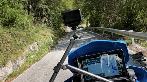
Narrow but paved, the route leads through predominantly wooded countryside from Stazzona to Aprica. The north-facing side is steep and extremely winding.
The picture shows the junction with the Panoramica del Passo di Guspessa – southern approach.
Passtracks close by:
Passo dell’Aprica, Passo di Guspessa, Panoramica del Passo di Guspessa, Passo del Mortirolo, Passo del Vivione
| Country | Italien |
| Region | Lombardia |
| Coordinates | 46.16975807, 10.15588366 |
| Elevation | 1427 m |
| Max. slope | 18 % |
| Toll road | no |
| Road surface | Asphalt, Gravel |
| Cul-de-sac | no |
| Length | 19 Km |
| Travel time | Slow |
| Route | Stazzona Aprica |
 broken clouds, -0.5°C
 Subscribe to Newsletter