


Pas de la Confession | 1542 METER | Allemond Le Bourg-d'Oisans
Some describe the pass as short, only counting the distance to the pass from the town of Huez. In reality, the ramp starts in the south in the town of Le Bourg-d'Oisans. In the town of Huez, the road then branches off to the northwest. After about 4 kilometres of mountain road, you reach the highest point, the Pas de la Confession. Both the southern and northern ramps have a large number of curves and sharp bends.
Since the route is a popular road for cyclists up to Alpe d'Huez, there is a lot of traffic.
If you follow the south ramp further up without taking the turnoff to Pas de la Confession, the road leads to the Lac Besson plateau at just over 2000 metres. The road then ends at the car park, although some route planners offer a route down to the village of Oz (as of June 2024). However, there are only hiking trails down here.
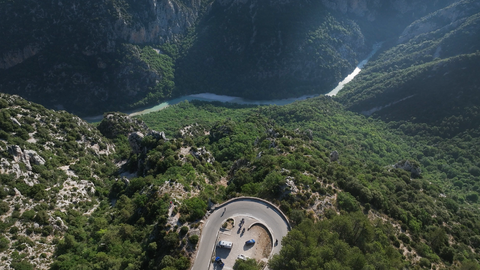
The Pas de la Confession high-altitude trail offers magnificent views in places.
West of Alpe d'Huez, a gravel road branches off towards the summit of Col de Sarenne. Easy to drive, beautiful views.
Suggested videos (Passtracks close by)
| Country | Frankreich |
| Region | Isère |
| Coordinates | 45.08027700, 6.04175800 |
| Elevation | 1542 m |
| Max. slope | |
| Toll road | no |
| Road surface | Asphalt |
| Cul-de-sac | no |
| Length | 25 Km |
| Travel time | Normal to slow |
| Route | Allemond Le Bourg-d'Oisans |
 broken clouds, 20.5°C