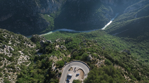
Col d'Illoire – a 180-degree bend with a view down into the 700-metre-deep Verdon Gorge.
9 hours ago
Strada dei Cannoni or the Varaita-Maira Ridge Road – off-road driving for connoisseurs.
1 month ago
The ‘Little St Bernard’, 2,188 metres: an Alpine pass set in picturesque countryside and steeped in history.
2 months ago


Region: Savoie
Col du Télégraphe | 1566 METER | St. Michel de Maurienne Valloire
The Col du Télégraphe is a mountain pass at an altitude of 1566 metres in the French Alps, more precisely in the Département Savoie. The well-maintained, asphalted road is the main connection between the holiday resort of Valloire and the Arc valley. In the north-eastern part, the route is very winding with some hairpin bends, whereas the road towards Valloire is rather unspectacular, which is due to the fact that Valloire is already at an altitude of about 1400 metres. However, there are unique panoramic views of the entire Valloire valley from here. The next pass in this direction, after Valloire, is the Col du Galibier.
Passtracks close by:
Col du Télégraphe, Col d’Albanne, Col de Beau Plan, Col du Mollard, Col de la Confrérie
Videos
Suggested videos (Passtracks close by)
| Country | Frankreich |
| Region | Savoie |
| Coordinates | 45.20250000, 6.44444000 |
| Elevation | 1566 m |
| Max. slope | 11 % |
| Toll road | no |
| Road surface | Asphalt |
| Cul-de-sac | no |
| Length | 18 Km |
| Travel time | Normal |
| Route | St. Michel de Maurienne Valloire |
 scattered clouds, 11.5°C
Hotels close by