


Col de Granon | 2413 METER | Saint-Chaffrey Val-des-Prés
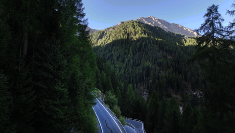
The Col de Granon is a mountain pass in the French Alps, located just north of the picturesque, late medieval town of Briancon. After about 5 kilometres towards the Col du Lautaret and Col du Galibier, you will reach the village of Saint-Chaffrey. This is where the western ramp to the Col de Granon begins. On this side of the Alpine pass, the road is completely asphalted. It is narrow and, in the upper area, without edge reinforcements. There are fascinating views of the Western Alps towards the Col du Galibier in the north and the town of Briancon with its many fortifications in the south, and the Col del'Izoard behind it.
The route from Saint-Chaffrey is about 13 kilometres long.
Just below the pass is a former military installation, which is definitely not in use at the moment. ‘Entering is still strictly forbidden’. There is a large car park at the top of the pass.
The picture shows the pass from the northwest. The military buildings can be seen clearly.
The eastern side of the Alpine pass is completely gravelled and currently (as of June 2024) designated as a military road, and therefore not passable – according to the signs. This route leads via the village of Val-des-Prés to the eastern valley of Vallée de la Clarée. This valley leads north towards Col de l'Echelle. This section is about 15 kilometres long. It first leads gently along the Alpine ridge towards the northeast, before taking many sharp bends in the lower part.
Videos
Suggested videos (Passtracks close by)
| Country | Frankreich |
| Region | Haute-Alpes |
| Coordinates | 44.96280000, 6.61111000 |
| Elevation | 2413 m |
| Max. slope | |
| Toll road | no |
| Road surface | Asphalt, Gravel |
| Cul-de-sac | no |
| Length | 28 Km |
| Route | Saint-Chaffrey Val-des-Prés |
 overcast clouds, 0.5°C
Hotels close by