

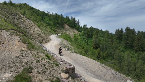
Strada delle Tre Valli – a 17-kilometre route of gravel and tarmac for off-road beginners.
5 days ago
Passo delle Fittanze della Sega | 1,393 metres: 30 hairpin bends, a 20 per cent gradient and 100 per cent panoramic views.
1 week ago
Colle di San Fermo | 1,074 metres: The western approach alone is a motorcyclist’s paradise, with 40 bends.
2 weeks ago




Region: Hautes-Alpes
Col Bayard | 1246 METER | Les Barraques Gap
The Col Bayard, at 1,246 metres, lies above Gap in the French Western Alps. The road is well-maintained, as it links Gap with the north. This route, the N85, even goes as far as Grenoble. To the south, just above the town limits, there are a few notable bends. The northern approach, on the other hand, is almost straight.
Tip: At the start of the northern approach, near the village of Les Barraques, a road leads westwards towards Le Noyer. This route takes you to the Col du Noyer, an Alpine pass that is absolutely delightful both in terms of scenery and driving.
Passtracks close by:
Col Bayard, Col de Manse, Col du Noyer, Col du Festre, Col Lebraut
| Country | Frankreich |
| Region | Hautes-Alpes |
| Coordinates | 44.61423653, 6.08124079 |
| Elevation | 1246 m |
| Max. slope | |
| Toll road | no |
| Road surface | Asphalt |
| Cul-de-sac | no |
| Length | 14 Km |
| Travel time | Fast to normal |
| Route | Les Barraques Gap |
 overcast clouds, 1.3°C
 Subscribe to Newsletter