


What is the best motorcycle tour planner?
Of course, you will now think that our recommendation is logically our own planning tool, the ‘Alpine Passes Atlas’. However, in addition to the clear presentation of destinations, which is perhaps unique to us, planning also includes navigation to the desired destinations.
And when it comes to destinations for motorbike tours in the Alps, we don't just mean alpine passes, but also selected sights and hotels that can be conveniently and sensibly integrated into your motorbike tour planning.
Using apps to plan motorcycle tours.
There are various apps available for planning and navigation. As a rule, apps that are designed for navigation while on the move are subject to a charge. Of course, these apps offer various additional functions, including the selection of a wide variety of winding routes. However, in order to make the right decision here, you need to be somewhat familiar with the route. It's easy to get stuck in a rut and only slowly reach your destination. A lot of it is just gimmicks.
The most important thing for us is to define clear intermediate destinations, discover something new along the way, plan in a few lesser-known or unknown alpine passes, and then arrive relaxed in the evening.
It is very important to always keep an eye on the traffic volume in order to better estimate arrival times. Then you will have the best possible driving experience.
Especially when touring the alpine passes by motorbike, the most interesting routes arise automatically – without any ‘route selection’ at all.
You don't need a paid app for that!
Our recommendation for motorbike tours in the Alps.
Combine the Alpine Pass Atlas for planning, whether on your desktop or mobile device, with Google Maps. This means clear, discovery-oriented planning combined with the market leader, which provides all ‘live traffic data’ and even current closures of Alpine routes – free of charge.
Even though we are reluctant to support market-dominating, perhaps even influential monopolists, Google Maps does the most reliable job here.
The simplest option for planning your motorbike tour and navigation:
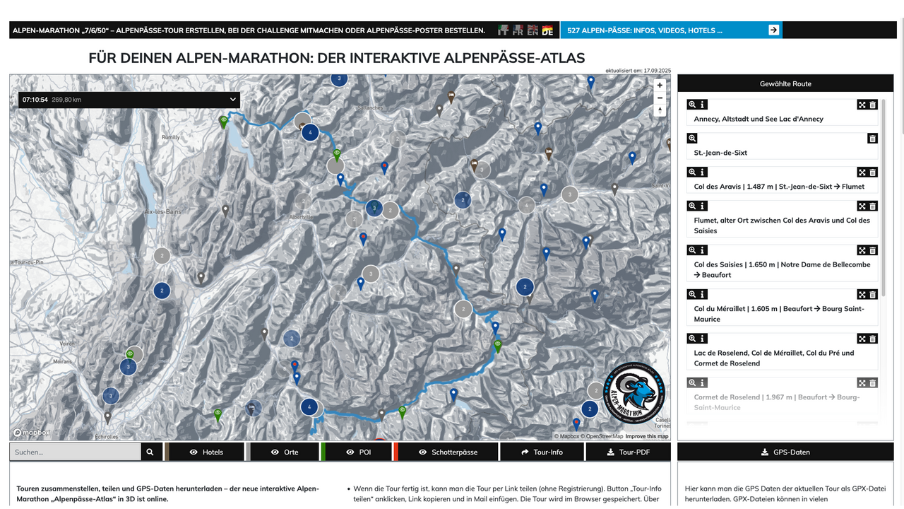
Put together your day trip using the Alpine Pass Atlas. Simply select your starting point, various Alpine passes, sights, hotels if necessary, and your destination, and view the length and duration. You can adjust this at any time by adding Alpine passes (move them using drag & drop) or, or, ...
Then enter your destinations via Google Maps and create a tour.
Why not use Google Maps? Because although Google Maps knows all the destinations, it does not display them, depending on the detail (resolution) of the map.
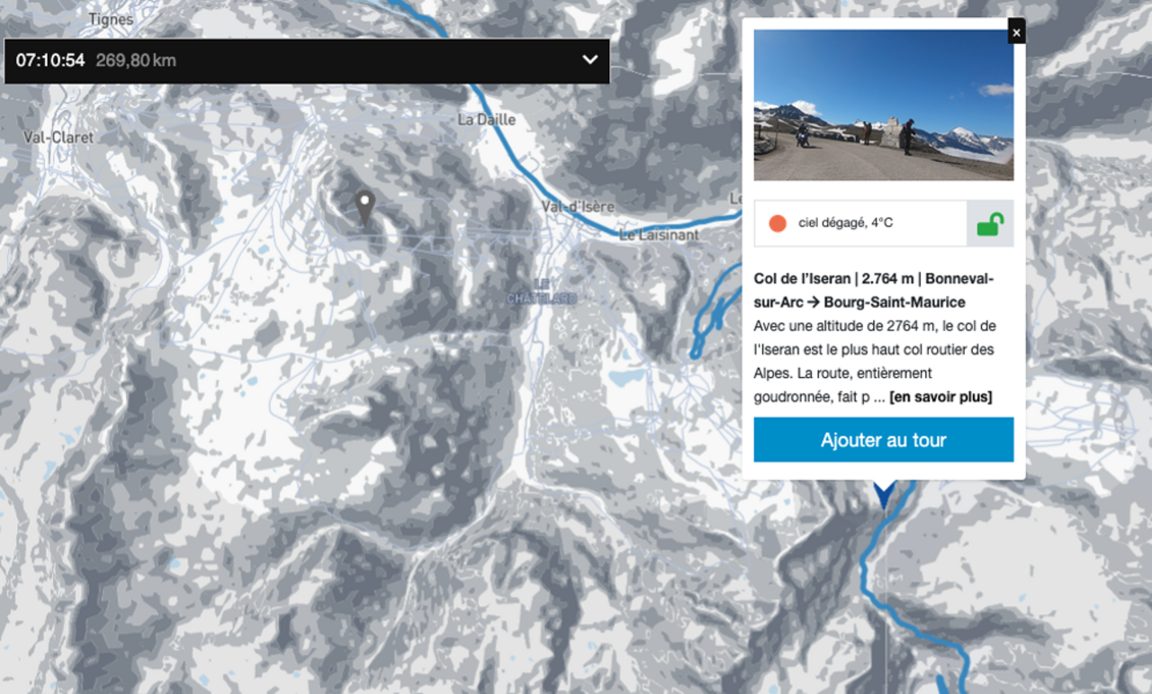
By the way: Another big advantage of our Alpine Pass Atlas is that all alpine passes are described in detail, and videos and facts about challenges can be viewed. Of course, this also applies to the sights.
You can also send planned motorbike tours to friends via a link (no registration required) and create and share fantastic, detailed and beautifully illustrated roadmaps at the touch of a button.
The convenient but sophisticated option for planning motorbike tours and navigation:
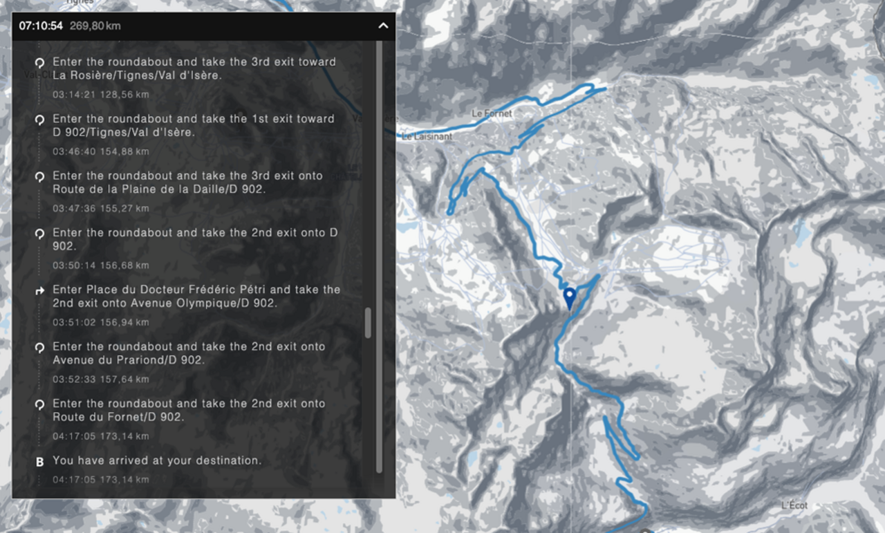
As already described, put together your day trip using the Alpine Pass Atlas. Then download the GPS data from the Alpine Pass Atlas, import it via myGoogle Maps and transfer it. We have created a tutorial for this.
The big advantage of this approach is that you can plan multi-day tours (day by day), save the GPS data for each day's tour, and then simply import it for the upcoming day's tour.
A tip for route lengths in the Alps: experienced drivers should plan for a maximum of 300 kilometres, or about 6-7 hours. This allows enough time for breaks and short trips to see the sights. Of course, this always depends on the difficulty of the planned alpine passes – hence the comparison with the time specification.