


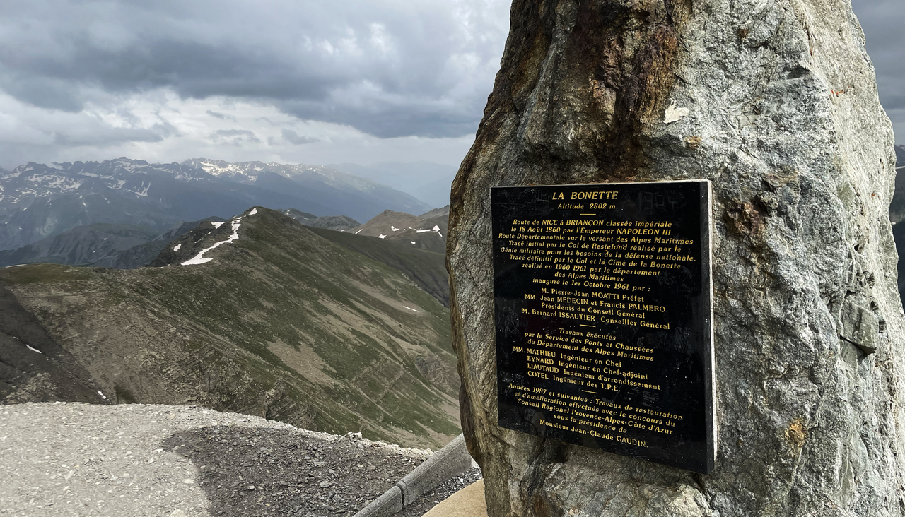
The Cime de la Bonette: 2,802 metres high!
The highest paved road in the Alps: around the Cime de la Bonette
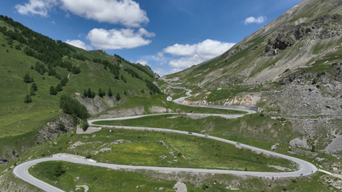
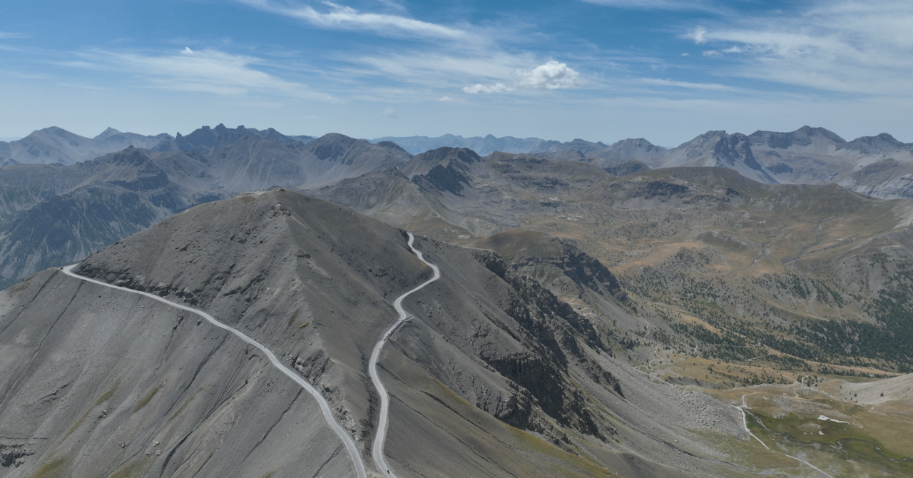
The highest paved road in the Alps runs around the Cime de la Bonette, reaching an impressive peak of 2,802 metres. It is often mistakenly claimed that this is also the highest paved Alpine pass. In fact, the Col de la Bonette, the actual mountain pass connecting the two sides, is located at an altitude of 2,705 metres. The loop around the summit of the Cime de la Bonette was built and paved later – it serves primarily as a tourist attraction.
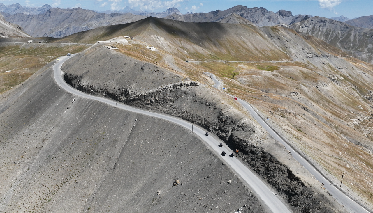
The panoramic road from the Col de la Bonette up to the highest point and back again, just over two kilometres long, is a real highlight – but weather permitting: it may be closed in strong winds or adverse conditions. When open, it offers an impressive driving experience along the Alpine ridge – with spectacular views and a unique high mountain atmosphere.
At the highest point of the road, there is an information board and several parking spaces. From there, you can continue on foot to the summit of the Cime de la Bonette – a short climb leads to a viewing platform with breathtaking panoramic views of the Western Alps. You can't get any higher in the Alps by car!
Not far west of the Col de la Bonette, about two kilometres away, lies the Col de la Restefond. From there, a popular off-road route branches off via the Col de la Moutière – an insider tip for adventure seekers with a vehicle suitable for off-road driving.
Want to discover more Alpine passes?
You can find a comprehensive overview of Alpine passes from A to Z with videos, pictures, facts and background information here – featuring over 450 Alpine passes.
You can use the digital, interactive route planner for Alpine passes directly here.
Or discover the Alpine Passes poster map (format 70 x 100 cm) – perfect for the garage, workshop or as a gift!
Matching: Alpine passes